
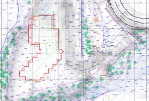
Preventing situations in flood-prone areas: An approach based on the EU floods directive and LiDAR technology
Floods are a major threat to human security, the environment, infrastructure and property. In the context of climate change and
Floods are a major threat to human security, the environment, infrastructure and property. In the context of climate change and

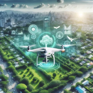
Introduction Technological developments in recent years have brought drones and LiDAR (Light Detection and Ranging) technology to the forefront as
Topographical surveys are an essential step in any construction project, providing precise data on the land and its characteristics. They

In the dynamic field of mapping and remote sensing technologies, drone photogrammetry orthomosaics have become essential tools in many industries.

Solar energy is a clean and inexhaustible resource that plays a crucial role in reducing greenhouse gas emissions and combating
Introduction In the context of rapid urbanisation and climate change, effective management of urban green spaces is becoming essential. Photogrammetric

Introduction Urbanisation is a growing global phenomenon and the use of advanced technologies such as 3D scanners and photogrammetric drones

The thermal imaging camera drone has many applications due to its ability to detect and visualise temperature variations in a

With the increasing use of solar energy and the development of photovoltaic parks, advanced technologies are becoming increasingly essential to

In the field of structural assessment of buildings, technology has advanced considerably, paving the way for more accurate and efficient

When a road accident occurs, authorities must close the road to traffic, sometimes for hours at a time, because they
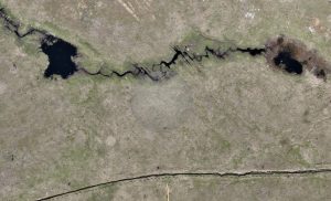
Photogrammetry is a data collection and analysis technique that is becoming increasingly important in the field of environmental disasters in

The 3D facade and building scanning service is a modern technology that can provide valuable information to architects or engineers

Nowadays, 3D building surveys are becoming increasingly popular and are replacing traditional designs by architects or surveyors for building extensions

3D scanning can be one way to start a 3D printing project. The construction of a three-dimensional representation of an

More complex surveying projects include 3D scanning with a specialised laser. To measure distances and very precise locations they use

New technologies make the present and the future “sound good” in terms of cadastre and topography. Today, companies operating in

Not many people know exactly what land registration entails and why so much important paperwork is needed when they want

Every construction project needs professionals, who offer specialised services, to develop it correctly and safely. This type of service also

Romania’s road infrastructure is a sensitive subject, especially for drivers, as it is quite poor. This is due both to
3D laser scanning is the geodetic technique by which the geometry of a structure can be measured fully automatically without

Cadastre is the part of the integrated cadastre and land registry system that deals with the technical, economic and legal
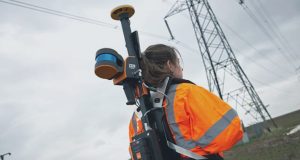
Handheld scanners are built for usability, portability and speed and use Simultaneous Locating and Mapping (SLAM) lidar to scan while

Virtual design and construction workflows and the growing adoption of BIM are beginning to revolutionise the construction industry. Traditional stationary

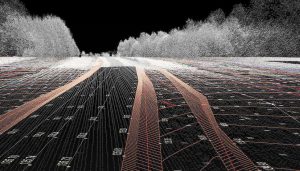
Mobile mapping technology is extremely valuable. Imagine scanning a 100km road or a shopping mall without it. GPS is part