

Topographical surveys are an essential step in any construction project, providing precise data on the land and its characteristics. They are crucial for the efficient planning and execution of construction projects.
Purpose of Topographic Surveys
The main purpose of topographic surveys is to obtain detailed data about the physical characteristics of a piece of land. This data includes contours, elevations, existence of natural or man-made features and other aspects relevant to the design. Topographical surveys are indispensable for the correct planning of constructions, avoiding possible problems with the terrain.
Equipment Used
Modern technology has brought various methods and equipment for carrying out topographic surveys, including:
- RTK GPS: These systems offer high accuracy in determining the positions of points on the ground.
- 3D scanners: Used to capture intricate details of existing terrain and structures.
- Drones: Combined with photogrammetry software, drones can create detailed 3D models of terrain.
Documents required for a topographical survey
The following documents are required for a topographical survey:
- Updated cadastre: Ensures that existing land information is up to date.
- Certificate of Urbanism for the Realisation of the Investment: This document is different from the one for information and is essential for the progress of the project.
- Owner’s Identity Card or CUI of the Company: confirms the legality of the application.
It is important to note that topographical surveys are carried out before the planning certificate is obtained. The urban development plan is based on the architect’s urban development proposal, which in turn is based on the data obtained from the topographical survey.
Case Study: Topographical Survey for the Construction of a Luxury Hotel at Lake Vidraru
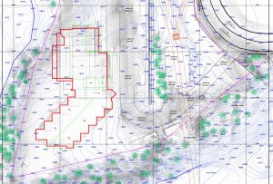
Recently, we had the opportunity to carry out a topographical survey for the construction of a luxury hotel near Lake Vidraru. This project required the use of state-of-the-art technology to capture the unique characteristics of the location. We used drones and photogrammetry software to create an accurate 3D model of the terrain.
The survey involved detailed measurements of the site, identification of natural and man-made features, and determining the best ways to integrate the building into the landscape. The results obtained were essential in architectural planning and structural decisions, ensuring an efficient and respectful implementation of the project in the natural context.
Conclusion
Topographic surveys are fundamental in the development of construction projects. Using advanced technology and following legal procedures, they provide the solid basis needed for the efficient planning and execution of any construction project.