

In the dynamic field of mapping and remote sensing technologies, drone photogrammetry orthomosaics have become essential tools in many industries. This article explores the nature of orthomosaics, their creation process through drone photogrammetry, and their critical importance in modern drone mapping services.
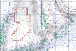
Defining Orthophotos Orthophotos are highly detailed and geometrically corrected aerial images made by stitching together several overlapping photographs captured by drones. These images differ from regular aerial photographs by eliminating distortions such as terrain relief and camera tilt, thus presenting an accurate to scale image of the earth’s surface. Orthomosaics are used as accurate base maps in areas such as agriculture, construction and environmental monitoring.
Fundamentals of Drone Photogrammetry Drone photogrammetry is based on capturing aerial images with high-resolution cameras mounted on drones. These images are further processed to create 3D models, maps and, of course, orthomosaics. This method is often more cost-effective than other technologies, such as drone LiDAR, and is ideal for projects requiring detailed and textured imagery.
The Orthomosaic Development Process Planning the View Careful planning of the drone’s flight path is essential. Altitude, image overlap rate and flight speed must be determined to ensure the quality of the final orthomosaic.
Image Capture With a well-defined flight plan, images can be captured using specialised photogrammetry drones. The use of drones with high-resolution cameras and GPS is crucial for optimal results.
Photo Processing After images are captured, they are processed with specialised photogrammetry software, such as Pix4D or Agisoft Metashape, to create orthophotos. This software merges overlapping photos, correcting any distortion and producing a geo-referenced orthophoto.
Orthorectification Orthorectification involves removing distortions from aerial images to ensure geometric accuracy and scale fidelity. These corrections are made taking into account factors such as the Earth’s curvature, camera tilt and variations in topography, using ground control points and advanced algorithms.
Advantages of Orthomosaics in Drone Mapping Services
- Spatial Accuracy: Orthomosaics provide a high level of spatial accuracy, essential for accurate mapping.
- Context: Provides clear and detailed images of the terrain, useful for interpreting LiDAR data.
- Consistency: allows easy integration and comparison of datasets captured at different times.
- Enhanced Analysis: Orthomosaics significantly improves the accuracy of data analysis.
- Interoperability: Easily integrates into GIS systems, joining other geospatial data such as LiDAR.
- Versatility: Applicable in various fields, from crop monitoring in agriculture to site planning in construction.
Conclusions The use of drone photogrammetry-generated orthophotos has transformed the approach to mapping and topographic assessments. This methodology offers an efficient and cost-effective way to obtain high-resolution images useful in various industries. The choice between drone LiDAR and photogrammetry depends on the specific project requirements, but for producing detailed and accurate 2D maps, orthomosaics is unrivalled.
For professional drone mapping services, including high-quality orthophotos and 3D maps, don’t hesitate to contact us. We are here to help your projects reach new horizons.